
Final Backpacking Days in Maine, Post 26-30

Updated: Sep 23
Lemonade completes her last six days of her planned section hike on the Appalachian Trail (AT) with mixed results while Trail Horse stays warm and dry in the van.
Wednesday, July 15 – Monday, July 20, 2026
South Arm Road to Stratton at Maine-27
It’s me, Lemonade/Sondra. Trail Horse/Jimmy managed the posts while I was out on the trail, and now I am back from the woods of Maine to share how the final days of the hike went, using his laptop (& Wix account) to get the blog posted. I realize this is a longer than usual blog post, but this was an epic backpacking trip for me and really wanted to try to capture these moments.
Click to see the video starting from Day 12-
Day 12 - Wednesday, July 15
Start: South Arm - 1950.9
End: ME 17 Height of Land - 1964.1
Miles: 13.2
Ascent: 4331 | Descent: 3563
Sleep: Van
After a delightful night with indoor plumbing, Trail Horse dropped Timex and me back off at the South Arm Road trailhead for another day of slackpacking.

We were cruising along pretty well when I banged my knee on rock at a pretty good clip. I sat down on said rock to observe how much bleeding my be involved. Since it was not running down my leg, I just got up and resumed hiking. Hindsight, I should have taken the time to clean the wound right then and there since a week later it appeared to have a slight abscess surrounded by angry red skin.
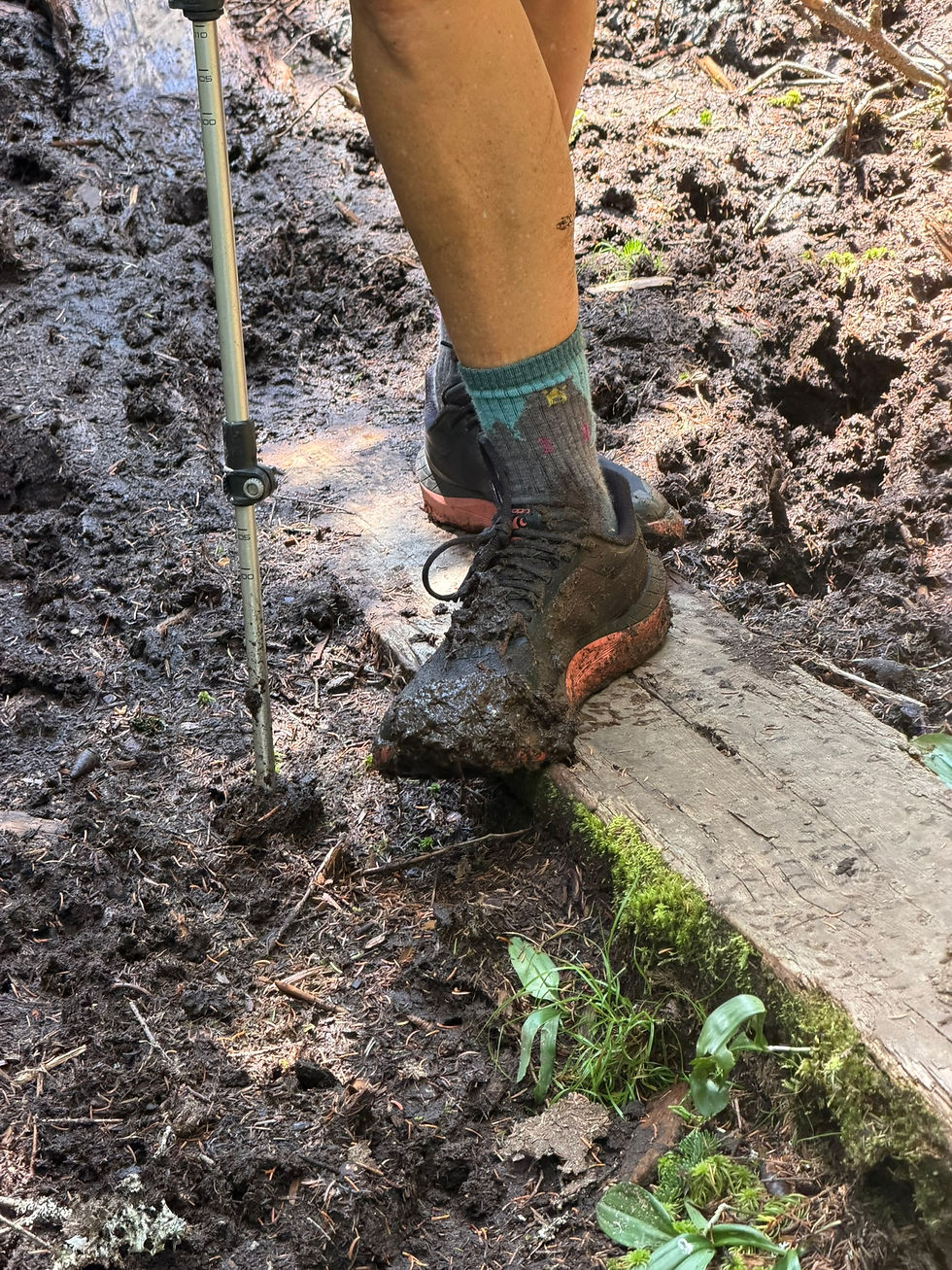
This was our longest milage and biggest ascent day to date with plenty of rebar rungs to climb. The last three miles of the hike had the toughest conditions of the day and we were rather beat when we reached the beautiful overlook called Height of Land.

Arriving at this overlook was special to me as we had driven past it in 2024 when we decided to skip the hardest 130 miles of the AT. I felt a sadness back then, assuming that that I would not ever have the opportunity to hike this portion of the trail. So, when we arrived, the joy of reaching this location by foot momentarily overwhelmed my fatigue.

Trail Horse’s Van Adventures:
After a night in the hotel, I dropped the ladies off at the trail and then scooted up to their pickup point called the “Height of Land” which is a very stunning overlook. There was a big pullout parking area for me to wait, and it actually had cell reception so I could keep myself entertained while I waited. Our intention was to camp at the Height of Land, but it was so windy and there was a lack of protected tent sites (for Timex) we decided to drive north to the trailhead at Maine 4 (Piazza Rock) to stay the night.
Day 13 - Thursday, July 16
Start: ME 4 - 1977.2 (SOBO)
End: ME 17 Height of Land - 1964.1
Miles: 13.1
Ascent: 2812 | Descent: 2237
Sleep: Van
It was so nice to have easier terrain today, which was my last day with Timex, and my last day of slackpacking. There were no rungs or ladders, and ascents and descents were never too long.
Trail Horse joined us during the first 30 minutes of the hike, and we had a nice surprise with seeing a moose down the trail. It was very dark brown and I vacillated between thinking, moose? bear?, no definitely a moose, with those long legs. Whoa, it is sooo tall!
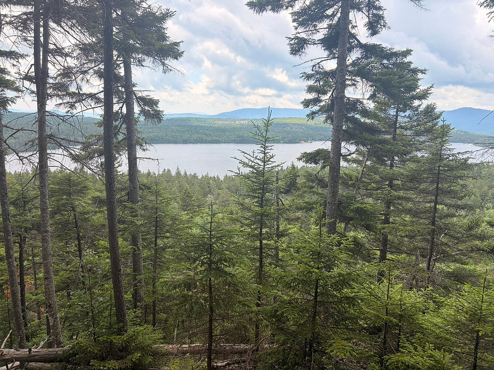
After a pleasant 10 miles of hiking, a downpour arrived, turning the final three miles into challenging hiking as we had to pick our way carefully over roots and rocks while navigating puddles of rain. At first neither Timex nor I put on our raincoats, thinking incorrectly it would be a short rainfall. After we became soaked and chilled, we stopped to put our jackets on to give us warmth.
Thankfully, Trail Horse was waiting at the road with the van running and the heater on. The drive to the hostel was long, and I was shivering when we arrived. A hot shower finally stopped the chills, and we went out for one last dinner with Timex, who had successfully completed her section.
Trail Horse’s Van Adventures:
Instead of driving back to Height of Land and for Lemonade and Timex to hike north, they decided to start where we camped and hike south back to where they got off the trail the day before (to close the gap). After hiking with them a short bit, I then drove back to the Height of Land to wait. It was very rainy (but I stayed dry), and Lemonade and Timex arrived pretty early but very wet (and cold). We then drove to the Maine Roadhouse hostel and we parked at their site while Timex stayed at the hostel. This is where Timex leaves us and it was great getting to know her over the past several days.
Day 14 - Friday, July 17
Start: ME 4 - 1977.2
End: Poplar Ridge Lean To - 1988.0
Miles: 10.8
Ascent: 3909 | Descent: 2587
Sleep: Tent
Saying goodbye was easier for both Timex and me since each of us had great adventures ahead of us. She was on her way to hike from Monson to Katahdin, and I was to begin a three-night hike into Maine woods with a full pack, four days of food plus a bear can since this portion of the trail does not have bear boxes.
Trail Horse had asked if I was nervous about the solo portion of my section hike. I responded that what feared me the most was the weight of my pack and the rather difficult first day. It turns out that was not a frivolous fear.
The trail started out kindly with a flatter terrain and I kept imagining that I was trying to catch up to Timex as was the usual case when we hiked together. As I encountered hikers that we had already met, they all asked where she was.
Once at Eddy Pond, it was time to begin the ascent up Saddleback Mountain (el. 4,122’), the first of three summits for the day. It was very steep and included several rungs and ladders but offered some very impressive views of the mountains to the south of me. In addition to great views, I was treated to meeting Deb and her dog Zeta who were waiting for her peak-bagging friend Gale to return from The Horn. I got to meet Gale on my way to The Horn, adding to the number of delightful people I got to meet on the trail.
Scenes from Saddleback Mountain
In the gap between Saddleback and The Horn, I found a beautiful cove that gave a protection from the brisk winds and sat down for a needed lunch.


Reaching the summit was not too bad, but the delights of the day diminished on the decent down as I maneuvered down some steep rock scrambles in brisk winds.
Next was Saddleback Junior, the final summit of the day. Although it is not over 4,000’ in elevation, it was a very difficult descent with even bigger rock scrambles and perhaps a questionable butt slide too. I found doing all three summits with my full pack to be very tiring and I was really dragging the remainder of the hike. When I arrived at Poplar Ridge Lean-to, I found Grey Beard, Scout, Rafiki and Pie there preparing their dinners and I was able to chat with them after setting up my tent while I prepared my dinner. In typical hiker fashion, everyone was laying down to sleep before the sun had set.
Trail Horses Van Adventures:
I dropped Lemonade off at Maine 4 and took off on my own exploration quest. In a couple of days Lemonade might come down a side trail to get off the trail for a night, letting her slackpack the last day of her section, that is if I could get to the pickup area with the van which is down a dirt road. Once I found Caribou Valley Road and started, it became apparent that this van might not be up to the challenge. I got about one, out of 4.5 miles into the trip and was starting to think about possibly turning around when I met another 4-wheel drive truck coming in the opposite direction. I talked to him for a bit and he advised me not to try it in the van. Luckly, their was a turn around a bit up the road and I made a quick retreat out of the woods. I let Lemonade know it was a no-go for a pickup on Sunday (luckily, she packed enough food until Monday due to our knowledge this meet up might not happen). So, I went to check into the campground I had picked out while waiting for Lemonade for three nights.
Day 15 – Saturday, July 18
Start: Poplar Ridge Lean To - 1988.0
End: Spaulding Mtn Lean To - 1996.0
Miles: 8.0
Ascent: 2246 | Descent: 2058
Sleep: Tent

Today I was very fatigued and was moving slowly. Part of me wants to hurry up, do extra big miles and hike to ME 27 tomorrow, yet my body is saying to take to easy. In addition to the fatigue, my toes hurt. I found blisters on the distal side of my large toes after the heavy downpour the other day and today they are quite painful. Three hours into the hike I took some ibuprofen and it may have helped a bit.
I plodded along for the rest of the day, which was not too difficult, although I was tired, with some rain sprinkling here and there. The most challenging point of the hike was a steep climb up Lone Mountain. The other challenge was happening in my head. The fatigue was getting to me, and I even wondered if I have Lyme disease, and was not fully enjoying the hike.
When I arrived at the lean-to at 2:00 p.m., Forrest, the 10-year-old, and his dad, along with a southbound hiker named Grits were there eating a late lunch. Even though it was early in the day, I set up my tent and rested the remainder of the day. I turned out that several other hikers arrived about 30 minutes later, all seeking shelter from the incoming rain.
Trail Horse’s Van Adventure:
Cold and rainy and nothing of note.
Day 16 - Sunday, July 19
Start: Spaulding Mtn Lean To - 1996.0
End: Crocker Cirque Campsite - 2002.2
Miles: 6.2
Ascent: 1816 | Descent: 2210
Sleep: Tent
Since I only had six miles to cover today, my plan was to sleep in late. However, with the end of the rain, strong winds arrived in the early morning and my tent stakes planted in soft soil were no match for the wind causing my tent to collapse on me. I was not looking forward to getting out of my sleeping bag and into the cold, windy air, but watching my tent and stakes flap wildly in the gusts was unnerving. I packed up and headed to the lean-to and discovered that nearly everyone had decided to delay their start as well. I added myself to the crowd, ate breakfast and commiserated with all the others.
One hiker that I had met several miles back, Closer, asked if I would be interested in hiking together today for some extra safety out on the wet rocks. I was miserably cold, a little cranky, and having company was nice to have. As we started, I could tell that my body benefited some from stopping early yesterday, however, my mental state was still a bit off.

We both left the shelter wearing two jackets all the way up the climb towards the summit of Sugarloaf. The strong winds stayed with us, and the first views of the day were covered in fog. About two hours later my fingers no longer ached from the cold. My second jacket was removed and replaced a few times through the hike.
As usual, the description for the decent off of Sugarloaf Mountain in FarOut proved to be over-hyped and was not too bad of a climb down. There was not a single iron rung today, just a butt-slide or two.
By the time we arrived at the campsite the wind was lighter, and the sun occasionally peaked out from the clouds. We set up our tents, had a late lunch and disappeared into our tents until meeting up again for dinner at 5:00. I never really warmed up, but at least I was no longer miserable.

Trail Horse’s Van Adventure:
Rain was pretty much over, but it was cold and windy so another day in the van with nothing to report.
Day 17 - Monday, July 20, 2026
Start: Crocker Cirque Campsite - 2002.2
End: ME 27 - 2009.5
Miles: 7.3
Ascent: 1925 | Descent: 3253
Sleep: Van
After yesterday’s even shorter hike and restful afternoon, I find myself in a much better mental and physical state this morning. My muscles still feel tired going up hills, but overall, the fatigue is not like it was two days ago. In addition, the sun visited us a good bit today, and I was very glad for the improvements in my energy level, mental status and weather (-I suspect the fatigue was from needing some rest, and perhaps I was not eating enough food).

Heading up South Crocker Mountain (el. 4,037’) was a fairly steep climb, but without any rungs or ladders. Then heading down and back up North Crocker (el. 4,213’) was not as bad. The descent from North Crocker was nothing to fear and we made very good time down to ME 27. I enjoyed Closer’s company on the hike, then on the way down, I had a pleasant surprise of seeing Trail Horse who had hiked in to meet us. It was very nice to end this year’s section hike on a good day.
Trail Horse’s Van Adventure:
Last day of the van adventure. Headed to the AT trailhead at about 11:30 am and started hiking toward Lemonade to escort her out of the woods. Met her in about a mile and we trekked back to the van with her hiking partner, Closer, for the last couple of days. We gave him a ride to the Maine Roadhouse and went back to the campground to start the process of getting ready to turn the van back in on Wednesday.
2026 Hike Summary
Distance hiked on the Appalachian Trail: 130 miles
Distance hiked on side trails: 10 miles
17 days with no zero days
Longest Day: 13.2 miles on Day 12
Most ascent in a day: 4331’ on Day 12
Most descent in a day: 3653’ on Day 3
With this hike complete, my unfinished portion of the Appalachian Trail is 308 miles (14%).
Currently I plan to complete the AT next summer. I’ll probably hike from Deep Gap, NC and through the Great Smoky Mountains in June. Then later in the summer I’ll finish up the trail by backpacking from Caratunk, Maine to Baxter Peak on top of Mount Katahdin. Rumor has it that Trail Horse may join me on one or both of these sections.
Post 26-30


Comments